
By Pam Marcum
The GTM Research Reserve is almost 74,000 acres spanning from Palm Valley to Palm Coast. That’s a lot of area to cover, so how did we decide where we should focus our Sentinel Site Application Module 1 (SSAM-1)? It started with evaluating what we already had in place.
Our System Wide Monitoring Program (SWMP- pronounced ‘swamp’) consists of four water quality monitoring stations, one weather station, and six marsh stations each containing 15 vegetation monitoring plots and three surface elevation tables (SETs). We have talked about SWMP before, check it out here and here! We created a map (below) of our current monitoring stations- all of which are components of the Sentinel Site program.
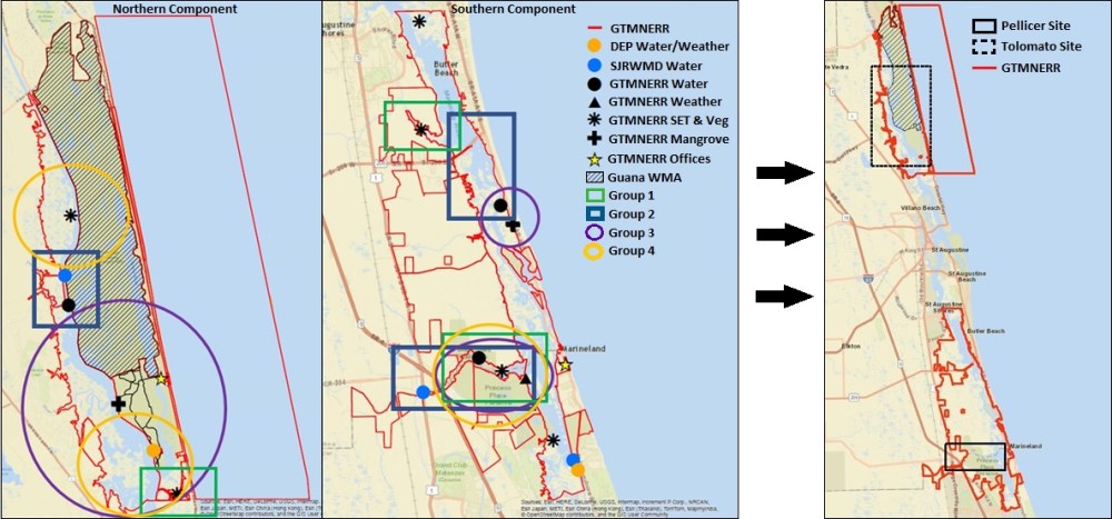
We then identified target areas on the map that we could apply the SSAM-1 based on:
- how many of the SSAM-1 components were already in place
- input from local residents, land managers, other researchers, and governments
- proximity to major freshwater sources
- representation of regional landscapes
After holding a public meeting to discuss location options, stakeholders identified key areas they would like to see the SSAM-1 implemented. With all of this input, and plenty of maps to go around, we narrowed down to two locations that would best serve our research needs and local interest.
“…stakeholders identified key areas they would like to see the SSAM-1 implemented.”
The location that made first priority was Pellicer Creek. This location checked off many of the boxes on the checklist for site selection: the watershed is > 90% undeveloped; the majority of the monitoring components were already in place; stakeholders identified the location as priority target; and the creek is the largest freshwater source to our region. However, because of the freshwater input, the surrounding marsh areas are very different from the rest of the region.
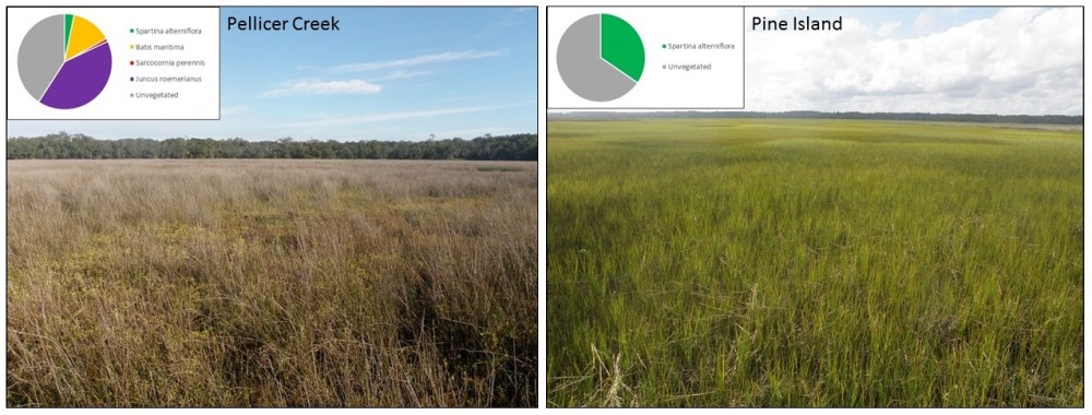
To better capture marshes typical of the northeast Florida region, the Pine Island area was targeted as second priority. This location also contains a couple of the components necessary for SSAM-1 implementation. This area is bounded by undeveloped preserves, making it ideal to understand how the marsh ecosystem naturally responds to changes.
With the Reserve narrowed down to two target areas, we can now shift our focus to what we need to do to implement the SSAM-1.
Stay tuned for the next installment to learn more about these next steps!
