
By Shannon Dunnigan
Hurricane Matthew approaches the northeast Florida coast this morning. The storm continues to pass along the eastern Florida coast just offshore. Presently it is within 20 miles offshore of Daytona Beach, Florida. Winds are around 120 mph, pressure 945 mb, and is moving NNW at 14 mph (weather.com).

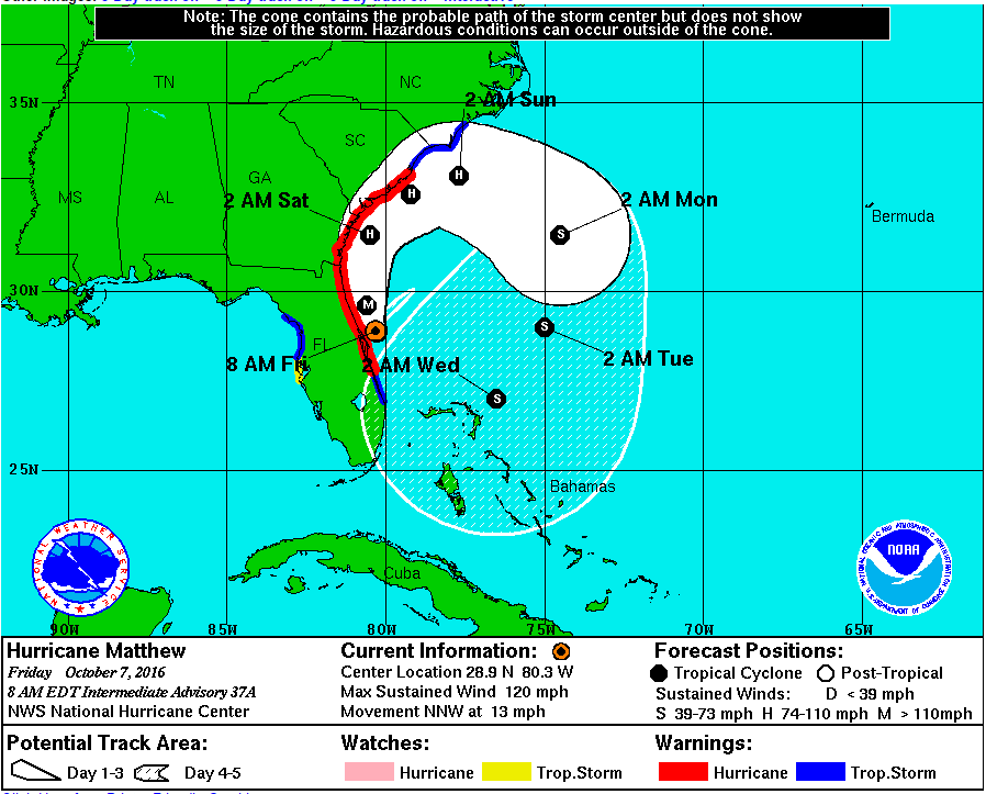
You can check out images of the coast using the Surfline.com website which gives you views of places like the St. Augustine Pier, Jackonville Beach Pier, Crescent Beach, and Flagler Beach Pier among others. Wave heights are currently estimated between 8-12ft in the Crescent Beach area and 6-8 ft in the Jacksonville Beach area. Storm surge is still predicted at 7-11 ft in the northeast Florida, Georgia through southeast South Carolina areas.

Our GTM weather station continues to see wind speeds increasing and barometric pressure dropping as the storm approaches the area. Gusts are coming in at 55 mph with sustained winds in the 30-35 mph range. The winds are primarily coming from the northeast as the storm builds to the south. Water levels on the beach and the Intracoastal Waterway continue to rise. Florida Department of Environmental Protection has several real-time water stations set up throughout the state. Check out one located at the Bing’s Landing boat ramp in the Marineland/Palm Coast area.


Stay safe and continue to stay dry everyone!
